"To describe the rest, instead"
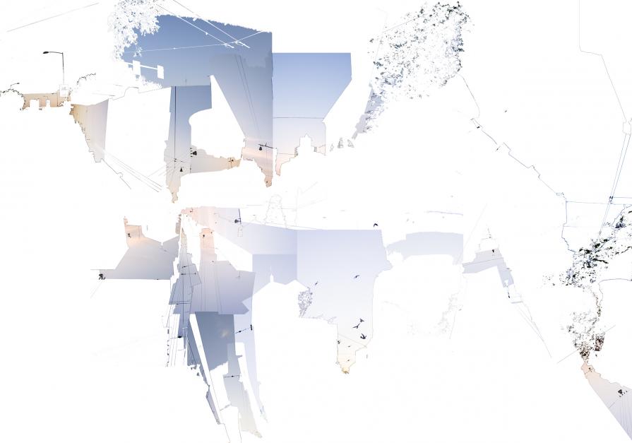
Can we create a plan of the sky? A map of the light? Or rather a map of the city drawn from the portion of sky on top of it? Can we consider the top of the buildings as a border? A border defining the vertical extension of a city, where the light isn't drawing the profile of the buildings anymore, but rather the opposite: the darkness of the building is profiling, above our head, an imaginary map of the sky.
The image, printed as a lithography, results from the collage of different photos of the sky, once freed from the architectural elements. Beside the cutting, purposely done with the magic tool so to preserve, conceptually, this idea of creating through the light, there is no digital manipulation. Similarly, none of the visible elements have been drawn.


Commenti 0
Inserisci commento