phantasmagoria of drones
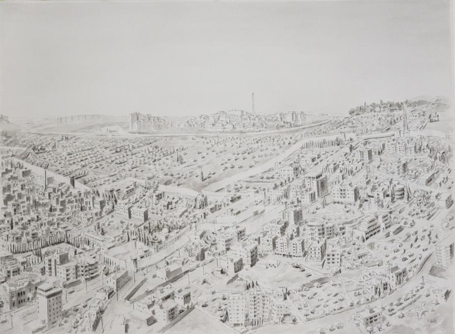
The first thing that came to mind when thinking about Rachel’s tomb in Bethlehem was that I never seen this area from above, google earth and bing do not recreate those views, and their 2D views are rather pixelated or a cloud is hovering above. There are hardly any such documents accessible to the public because it’s a contested area. The drawing is a bird eye view of a complex territory: tombs (including Rachel’s), wall, roads, checkpoint, heterogeneous urban fabric, refugee camp, settlement, traditional landscape…and a reference of old maps depicting places from above and pilgrimage maps to the « holy land ». The process of writing this view with very little material and not being able to fly a drone and take a picture demanded scouting the whole area. Rachel’s tomb is sited at the heart of this sector. It’s a holy shrine sacred for the three monotheistic religions. For a long time it was “shared”. Jews and Christian consider it as Rachel’s tomb, for Muslims it’s Bilal Bin Rabah’s shrine an ottoman period building sited by a Muslim graveyard. Following the annexation of the west bank of the Jordan River by the Hebrew state in 1967, the tomb was turned into a simulacra of a synagogue. As far as I recall there has always been military presence there. Following regular confrontations during he 80’ and 90’ the tomb was enclosed in 1996 by military fortifications. In 2003 the building of the Wall has excessively reinforced this security device. The wall sinks deep in the built fabric of north Bethlehem, methodically encircling the urban while digging a corridor to fortify the access of the tomb. The landscape is transfigured, and the tomb sanctuarized to extremes. This device is a metaphor of the so-called securization deployed by Israel on the Palestinian territories: from the mise en abyme to the abyss of separation, a tomb that seems to bury those territories.


Comments 0
Say something